


Phulara Ridge Trek: A Complete Guide to Uttarakhand’s Scenic Ridge Trail
Some Himalayan treks take you to a summit, give you a few minutes to enjoy the view, and then send you downhill.
Phulara Ridge Trek does something different.
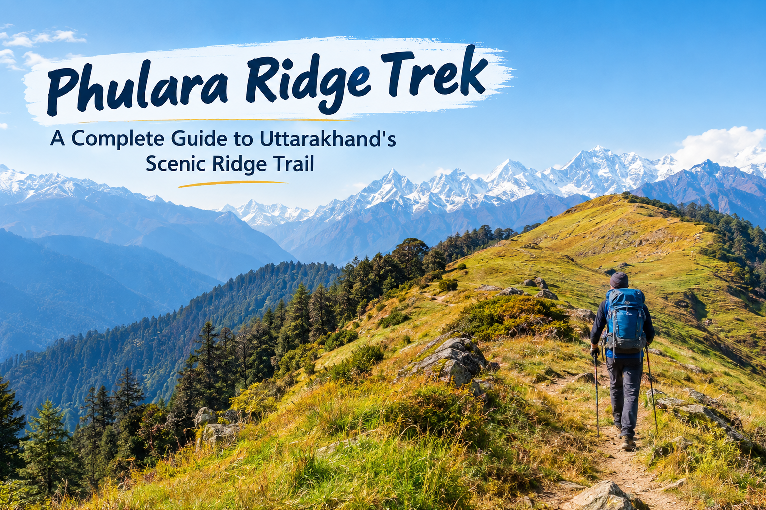
Instead of making the summit the only big moment, this trek gives you a long walk along a high mountain ridge. You get open views on both sides, forests, meadows, distant snow-covered peaks and a trail that keeps changing as you walk.
The trek is located in the Uttarkashi district of Uttarakhand and is generally approached from the Sankri region. The route is associated with the Govind Wildlife Sanctuary and the surrounding Western Himalayan landscape.
If you want a Himalayan trek where the journey itself is the main attraction, Phulara Ridge deserves a place on your list.
What Makes Phulara Ridge Trek Special?
The biggest attraction is, of course, the ridge walk.
A ridge is a high, narrow stretch of land connecting mountain slopes or peaks. On Phulara Ridge, you spend a significant part of the trek walking at high elevation rather than simply climbing to a summit and turning around.
That changes the experience completely.
On one side, you can see mountain slopes dropping into valleys. On the other, you get wide views of the Himalayan landscape. Weather permitting, the trail offers views towards peaks and ranges such as Swargarohini, Bandarpoonch, Kalanag and other surrounding mountains.
And then there are the meadows.
Bhoj Gadi and Pushtara are two important scenic sections of the trek. Pushtara is especially known for its broad meadow landscape, while Bhoj Gadi makes an attractive high-altitude camping area.
In simple words, Phulara Ridge is less about chasing one viewpoint and more about enjoying an entire day of mountain scenery.
Phulara Ridge Trek at a Glance
| Trek Detail | Information |
|---|---|
| Location | Uttarkashi, Uttarakhand |
| Main approach | Sankri region |
| Highest point | Around 12,150–12,345 ft, depending on the route description |
| Trek duration | Usually around 5–6 days |
| Trek distance | Roughly 26–29 km on commonly published itineraries |
| Difficulty | Easy to moderate to moderate |
| Main highlights | Ridge walk, forests, meadows and Himalayan views |
| Major camps/sections | Juda Ka Talab, Bhoj Gadi, Pushtara and Taluka on common itineraries |
| Best seasons | Spring/early summer and autumn are commonly preferred |
Published itineraries vary slightly in distance, altitude and starting arrangements. For example, Indiahikes currently describes a route through Kotgaon with a high point of 12,345 ft, while Trek The Himalayas lists a Sankri-based itinerary reaching around 12,150 ft.
So, always check the exact itinerary with your trek operator before booking.
Where Is Phulara Ridge Trek Located?
Phulara Ridge lies in the wider Sankri region of Uttarkashi district in Uttarakhand.
Sankri is already well known among trekkers because several Himalayan routes begin from this area, including Kedarkantha and Har Ki Dun. The landscape around the region includes forests, alpine meadows, mountain streams and high Himalayan terrain.
The surrounding protected landscape is also important from an ecological point of view.
Govind Wildlife Sanctuary was established in 1955, and the wider protected area supports Western Himalayan forests and a wide range of wildlife and bird species. The Wildlife Institute of India notes that the protected landscape includes subtropical, temperate and alpine zones.
That is one reason the trek feels more than just a walk between campsites.
You are moving through a living mountain ecosystem.
Phulara Ridge Trek Route and Itinerary
The exact itinerary can change between operators, but a commonly published version follows a route from Sankri towards Juda Ka Talab, then Bhoj Gadi, across Phulara Ridge to Pushtara and finally down towards Taluka.
Day 1: Dehradun to Sankri
The journey normally begins with a long road drive towards Sankri.
The road takes you deeper into the mountains, and the landscape changes gradually from towns and highways to valleys, forests and mountain villages.
Sankri sits at around 6,400 ft according to published trek itineraries.
Do not treat this day as boring travel time.
It is your first step into the trekking region, and a good night's rest here can make the following days much easier.
Day 2: Sankri to Juda Ka Talab
The trek begins properly from Sankri.
The trail climbs through forest sections towards Juda Ka Talab. Published itineraries put the distance at roughly 4–5 km, with Juda Ka Talab around 9,100 ft.
The forest section gives you a gradual introduction to Himalayan trekking.
You gain altitude, so walking slowly matters. There is no prize for reaching camp first. Your knees will not send you a thank-you letter.
Day 3: Juda Ka Talab to Bhoj Gadi
The next section takes you higher towards Bhoj Gadi.
The landscape starts changing as you gain altitude. Forests give way to more open areas, and the mountain views become more noticeable.
Trek The Himalayas lists this section at around 7 km, while other itineraries may divide the route differently.
Bhoj Gadi sits at roughly 11,100–11,170 ft in commonly published itineraries.
This is an important night because the next day brings the main ridge section.
Day 4: Bhoj Gadi to Pushtara via Phulara Ridge
This is the day most trekkers wait for.
From Bhoj Gadi, the trail climbs towards the ridge. Once you reach the high section, the landscape opens up dramatically.
The ridge itself is the main attraction.
Instead of walking inside a forest for most of the day, you get long stretches of open terrain with mountain views on both sides. Indiahikes lists this section at around 8.4 km, with the trail reaching approximately 12,345 ft before descending towards Pushtara.
The ridge can also be windy and exposed.
If there is snow or slippery frozen ground, the same trail can become more demanding. That is why weather conditions and current trail conditions matter more than simply looking at a difficulty label online.
After the ridge, the trail descends towards Pushtara.
And Pushtara is a completely different experience again.
The wide meadow opens up around you, making it one of the most memorable sections of the trek.
Day 5: Pushtara to Taluka and Drive to Sankri
The final trekking section usually involves a long descent through forest towards Taluka.
The landscape becomes greener and denser again as you lose altitude.
Indiahikes lists this section at around 8.1 km, while another published itinerary puts the Pushtara–Taluka section closer to 12 km. This difference shows why trekkers should check the exact route and itinerary being used by their operator.
From Taluka, the journey continues by road towards Sankri.
Day 6: Sankri to Dehradun
The final day is mainly a road journey back to Dehradun.
Mountain travel takes time, and road conditions can affect arrival times.
If you have a train or flight to catch, keep a reasonable buffer instead of planning everything down to the last 20 minutes.
Mountains have never been particularly interested in our Google Calendar.
How Difficult Is Phulara Ridge Trek?
Phulara Ridge is commonly described as easy to moderate or moderate, depending on the itinerary and conditions.
That does not mean you can arrive with zero preparation and expect the Himalayas to do all the work.
The main challenge comes from altitude, long walking days, ascents and descents. The ridge section can also become more difficult in snow, strong wind or poor weather.
Indiahikes describes its route as moderate and notes that the trek reaches 12,345 ft. It also highlights a significant elevation gain during the earlier trekking days.
A reasonably active person who prepares with regular walking, stairs, jogging or similar cardio can generally build a useful fitness base.
But fitness does not remove altitude risk.
Altitude sickness can affect both beginners and experienced trekkers. Slow movement, proper acclimatization, hydration and following your trek team's instructions are important at high altitude.
Best Time for Phulara Ridge Trek
The best season depends on what you want to see.
Spring and Early Summer
April to June can bring greener landscapes and seasonal flowers.
The forests and meadows start looking fresh, and the trail can offer a different experience from autumn.
Snow may still remain on higher sections early in the season, so conditions can change from year to year.
Autumn
September to November is another popular period.
After the monsoon, the skies can become clearer and mountain views can be excellent. The landscape also starts moving towards autumn colours.
Trek operators commonly list May, June, October and November among the preferred months for Phulara Ridge.
Winter
Winter changes the character of the trek.
Snow can make the ridge and higher sections more challenging. Trail conditions can vary considerably, so winter trips require more attention to weather, snow depth and the current condition of the route.
Do not choose winter simply because snow looks good in photographs.
Snow looks beautiful until your boots are wet.
Flora, Birds and Wildlife Around the Trail
The Phulara Ridge region sits within a landscape known for its Himalayan forests and wildlife.
The protected Govind landscape includes species such as Himalayan monal, musk deer, Himalayan tahr and several other animals. Its forests include oak, deodar, spruce, fir, rhododendron and other Himalayan vegetation.
Trekkers may also hear or spot birds while walking through forest sections.
But wildlife sightings are never guaranteed.
The right approach is simple: observe quietly, keep your distance and never try to feed or approach wild animals.
How to Reach Phulara Ridge Trek
For the commonly published Sankri-based route, Dehradun is an important transport point.
From Dehradun, trekkers travel by road towards Sankri. Published itineraries generally put the drive at around 200 km and roughly 9–10 hours, although actual travel time depends on road and weather conditions.
Some current itineraries use Kotgaon instead of Sankri as the trekking start point.
Therefore, do not book transport based only on the trek name.
Check the starting village mentioned in your booking confirmation.
What Should You Pack?
Keep your backpack practical.
You will need good trekking shoes, warm layers, a rain jacket, gloves, a cap, sunglasses, sunscreen, personal medicines, a water bottle and basic toiletries.
For colder months, add suitable thermal layers and warmer gloves.
A headlamp is also useful, even if your itinerary does not involve night trekking.
And keep your backpack light.
The mountain does not care how many T-shirts you own.
Responsible Trekking on Phulara Ridge
Phulara Ridge passes through a sensitive Himalayan environment, so responsible trekking matters.
Carry your waste back with you. Avoid single-use plastic wherever possible. Do not damage plants, disturb wildlife or leave food waste around campsites.
The protected area is home to important Himalayan flora and fauna, so trekkers should follow local forest and sanctuary rules. Official information on the Govind protected area also highlights its ecological importance.
A beautiful trail stays beautiful only when people treat it properly.
Is Phulara Ridge Trek Worth Adding to Your Trek List?
Phulara Ridge offers something that many Himalayan treks do not: a long high-altitude ridge walk where the views remain part of the journey rather than appearing only at the final summit.
You get forests, open meadows, mountain views, changing terrain and the unique experience of walking along a ridge at high elevation.
It also offers a useful balance for trekkers who want something more demanding than a very short beginner trek but do not necessarily want a technical Himalayan expedition.
The exact difficulty depends on the season, weather, snow and itinerary.
So prepare properly, choose a reliable trekking setup and respect the mountains.
If your idea of a good trek is walking for hours with huge Himalayan views around you rather than simply taking a summit photo and coming back down, Phulara Ridge Trek is certainly a route worth exploring.
Frequently Asked Questions
What is the highest point of Phulara Ridge Trek?
Commonly published itineraries place the highest point around 12,150–12,345 ft. The exact figure varies by route and operator.
Is Phulara Ridge Trek suitable for beginners?
It can suit fit beginners, but it is not a casual walk. The trek involves altitude gain, long walking days and exposed ridge sections. Basic physical preparation is important.
How many days are needed for Phulara Ridge Trek?
Most commonly published itineraries take around 5–6 days, including the road journey from and back to Dehradun.
Which is the best season for Phulara Ridge Trek?
Spring and early summer offer greenery and seasonal flowers, while autumn is known for clearer mountain views and changing colours. May, June, October and November are commonly listed by trek operators.
Where does the Phulara Ridge Trek start?
Sankri is the traditional base for many published Phulara Ridge itineraries, although some current routes use Kotgaon as the trekking start point. Always confirm the starting village with your trek operator.
Final Thoughts
Phulara Ridge is not just another trek where you climb uphill, reach a viewpoint and head back.
Its real strength is the ridge itself.
The combination of high-altitude walking, forests, meadows and open Himalayan views makes the route different from many conventional summit-focused treks.
And because weather and trail conditions can change quickly in the mountains, good preparation matters as much as enthusiasm.
Pack smart, train your legs, respect the local environment and leave some space in your camera.
You are going to need it.

 English
 Arabic
 French
 Spanish
 Portuguese
 Deutsch
 Turkish
 Dutch
Dutch
 Italiano
 Russian
 Romaian
 Portuguese (Brazil)